Clark Labs is pleased to announce the release of TerrSet 2020 – an important update to our integrated constellation of software applications for monitoring and modeling the Earth system. Improvements with this version are primarily focused on the IDRISI Image Processing tools and the Land Change Modeler.
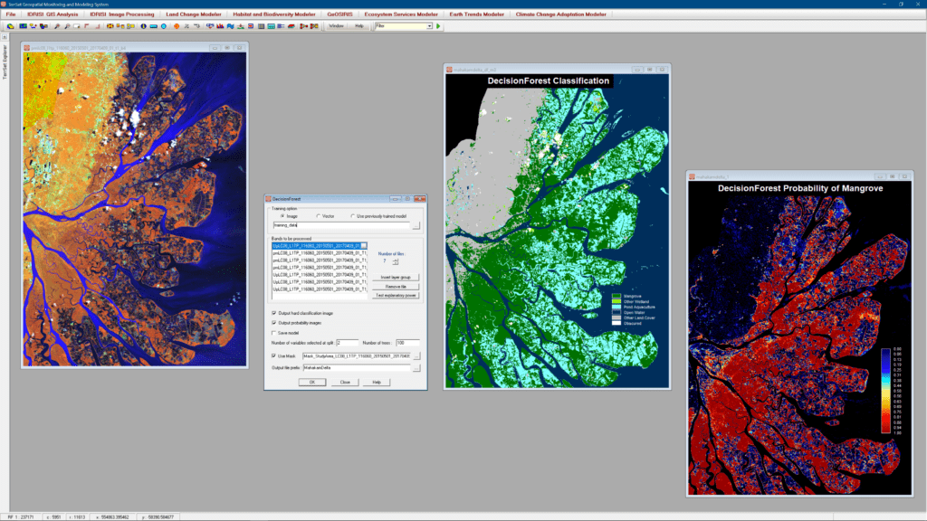
The IDRISI Image Processing component has seen extensive changes including new machine learning classifiers (SVM and DecisionForest), extensive on-screen digitizing tools, and specialized software for the ingest and radiometric correction of major provider imagery, such as Landsat, Sentinel, and DigitalGlobe (WorldView, QuickBird and GeoEye).
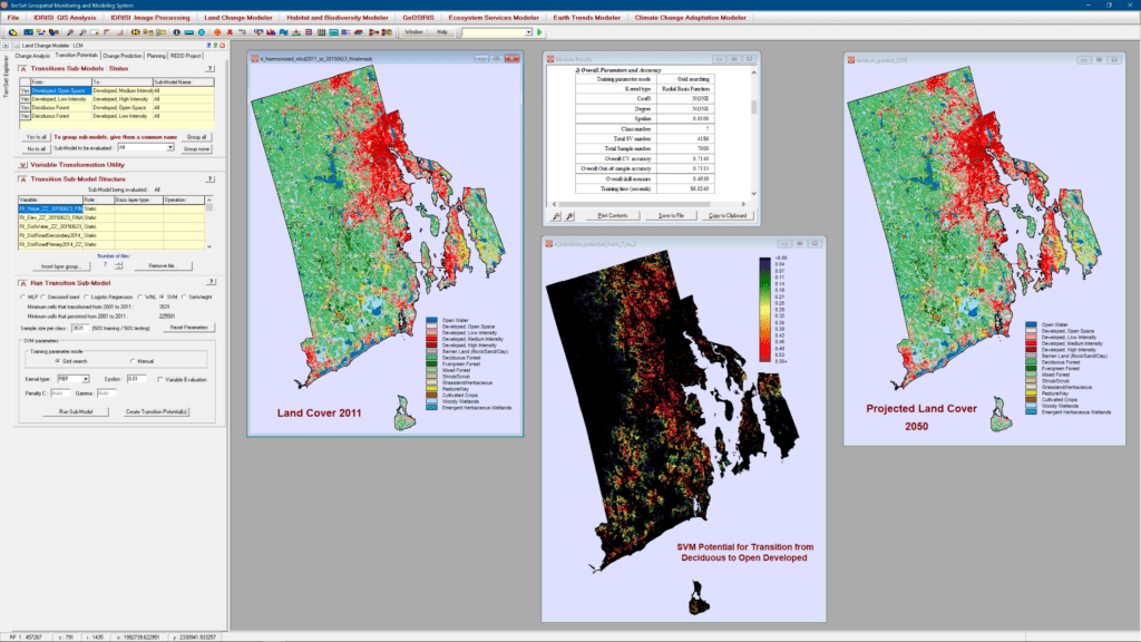
The Land Change Modeler (LCM), a mainstay of the land change, conservation, smart development and REDD (Reducing Emissions from Deforestation and forest Degradation) communities, has undergone a major reworking to enhance its stability and to provide new empirical modeling tools. Alongside the Multi-Layer Perceptron (MLP), Logistic Regression and Simweight (KNN) modeling approaches, LCM now also supports SVM (Support Vector Machine), DecisionForest (an implementation of Random Forest), and WNL (Weighted Normalized Likelihoods) – a fast modeling procedure for large numbers of transitions.
Developed in close cooperation with leading institutions focused on sustainable development and environmental conservation, TerrSet 2020 provides groundbreaking tools for addressing major challenges to smart growth and climate and habitat change, including impacts on ecosystem services and biodiversity.