Skip to navigation Skip to content
Clark Labs
  • PRODUCTS
    • TerrSet
    • Additional Products
    • Aquaculture Data
  • SERVICES
  • SUPPORT
    • Support
    • Download
    • TerrSet Tutorial Videos
    • White Papers
    • Bibliography
    • Resource Centers
  • BUY
  • PRODUCTS
    • TerrSet
    • Additional Products
    • Aquaculture Data
  • SERVICES
  • SUPPORT
    • Support
    • Download
    • TerrSet Tutorial Videos
    • White Papers
    • Bibliography
    • Resource Centers
  • BUY
  • $0.00 0 items
Home / White Papers /  Land Cover Mapping and the Use of Spatial Priors for Forest Classification / Land Cover Mapping and the Use of Spatial Priors for Forest Classification

Land Cover Mapping and the Use of Spatial Priors for Forest Classification

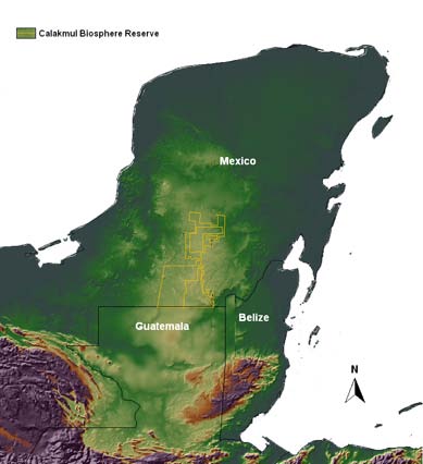
Land Cover Mapping and the Use of Spatial Priors for Forest Classification

Location of the Calakmul Biosphere Reserve.

Post navigation

Previous post:  Land Cover Mapping and the Use of Spatial Priors for Forest Classification

| ABOUT | NEWS | RESEARCH | CONTACT | PRIVACY

© 2022 Clark Labs, Clark University 950 Main St., Worcester MA 01610 USA

Clark University

  • Search
  • Cart 0