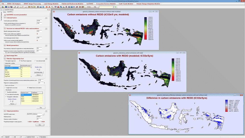
GeOSIRIS is a national-level planning tool for REDD that allows the user to specify the price of carbon, national level objectives for carbon emissions, the distribution of offset income between national and local levels, and a variety of economic parameters such as price elasticity of demand for agriculture on newly deforested land. GeOSIRIS empirically determines the effective opportunity cost based on a set of environmental variables and a provided map of potential agricultural revenue. Outputs include maps of expected carbon emissions with and without the proposed REDD policy as in the example for Indonesia above.