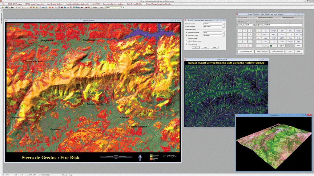
The foundation for TerrSet is the IDRISI GIS suite of analytical tools. This figure illustrates some of the many GIS analysis tools provided. These include a risk mapping based on a multi-criteria evaluation, a modeling of surface runoff incorporating information on precipitation and soil infiltration and the use of the the Image Calculator for basic map algebra tasks. The bottom right shows a view of the FlyThrough interactive 3-D flight viewer.