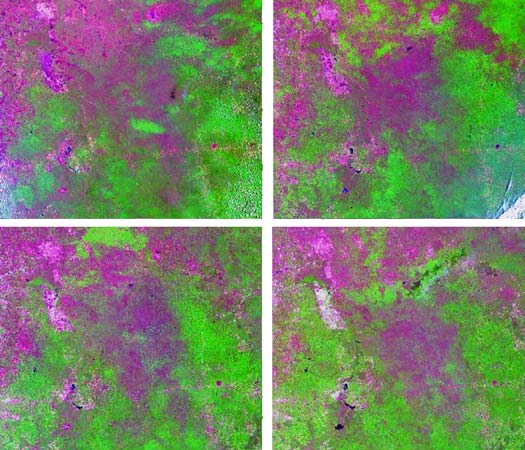
Variability in deciduousness. Landsat TM and ETM+ bands 543 RGB composite. Top left: April 1988; top right: May 1992; bottom left: March 1995; bottom right: March 2000. Areas in tones of magenta represent different degrees of leaf loss while tones of green represent green vegetation.