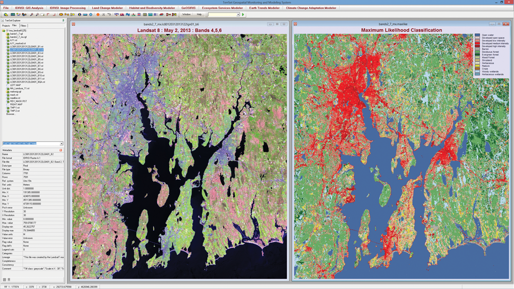
TerrSet includes the IDRISI image processing toolset with the most extensive set of classifiers for remotely sensed imagery in the industry. In this example, a Landsat 8 image of Rhode Island for May 2103 was classified using a Maximum Likelihood classifier and training data for classes consistent with the U.S. National Land Cover Database (NLCD).