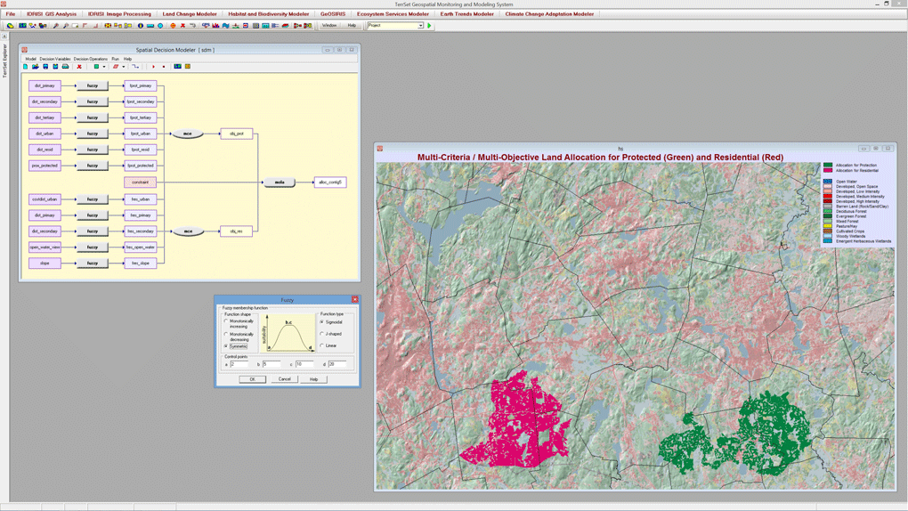
The Spatial Decision Modeler in TerrSet is a graphical modeling tool for multi-criteria and multi-objective decision support. This modeler incorporates tools for use of fuzzy sets to convert variables, the Analytical Hierarchy process to derive factor weights, and Ordered Weighted Averaging for multi-criteria evaluation. The tool also contains features for multi-objective land allocation that allows one to set land allocation targets based on either area or cost. There is also a facility to control contiguity and compactness in the land allocation process.