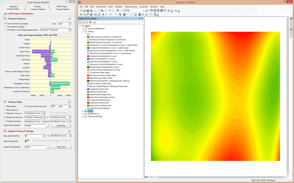
Land Change Modeler provides a utility for mapping the spatial trend of change, a very useful abstraction tool in areas of complex change. Polynomial trend surfaces up to the 9th order can be mapped. In this example, the spatial trend of change is mapped from all land cover categories to residential land cover. Areas in red exhibit the greater amount of change between 1985 and 1999.