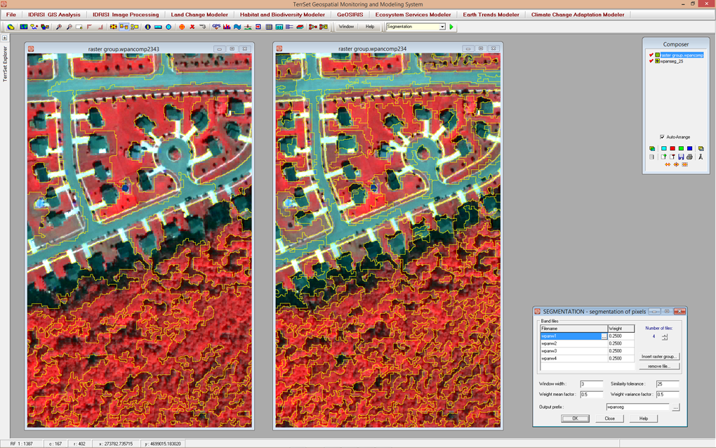
The SEGMENTATION module creates an image of segments that have spectral similarity across many input bands. This example shows two levels of segmentation from panmerged Quickbird imagery. The image on the left uses a larger similarity threshold than the one on the right, resulting in more generalized, less homogeneous segments. Altering this threshold allows for the segmentation of objects, such as forest stands, tree crowns or buildings.