TerrSet Geospatial Monitoring and Modeling Software
TerrSet is an integrated geospatial software for monitoring and modeling the earth system. The TerrSet software incorporates the IDRISI GIS Analysis and IDRISI Image Processing tools along with a constellation of modeling environments to analyze land change, image time series, ecosystem services, habitat and biodiversity, climate impacts, and REDD.
TerrSet operates on Microsoft Windows operating systems and comes with extensive tutorials and data.
Additional Products
Clark Labs offers additional products including data, a remote sensing guide book, and incident support, to enhance your user experience.
Aquaculture Data
Coastal habitat maps focusing on mangrove and pond aquaculture for 17 countries for the years 1999, 2014, 2018, 2020 and 2022.
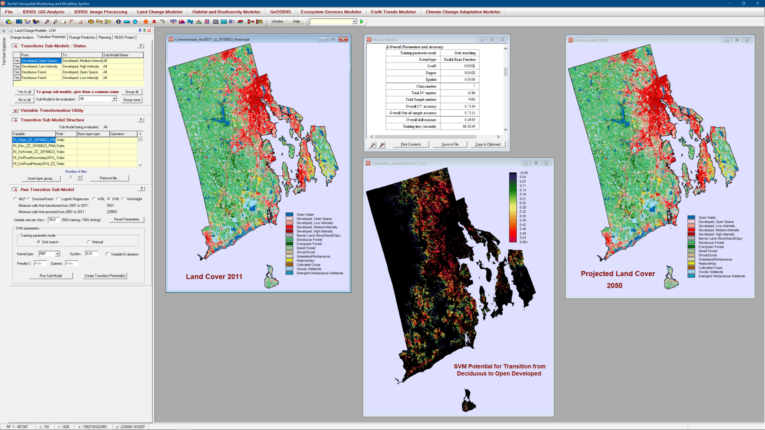
The Land Change Modeler (LCM), a mainstay of the land change, conservation, smart development and REDD (Reducing Emissions from Deforestation and forest Degradation) communities, has undergone a major reworking to enhance its stability and to provide new empirical modeling tools. Alongside the Multi-Layer Perceptron (MLP), Logistic Regression and Simweight (KNN) modeling approaches, LCM now also supports SVM (Support Vector Machine), DecisionForest (an implementation of Random Forest), and WNL (Weighted Normalized Likelihoods) – a fast modeling procedure for large numbers of transitions.
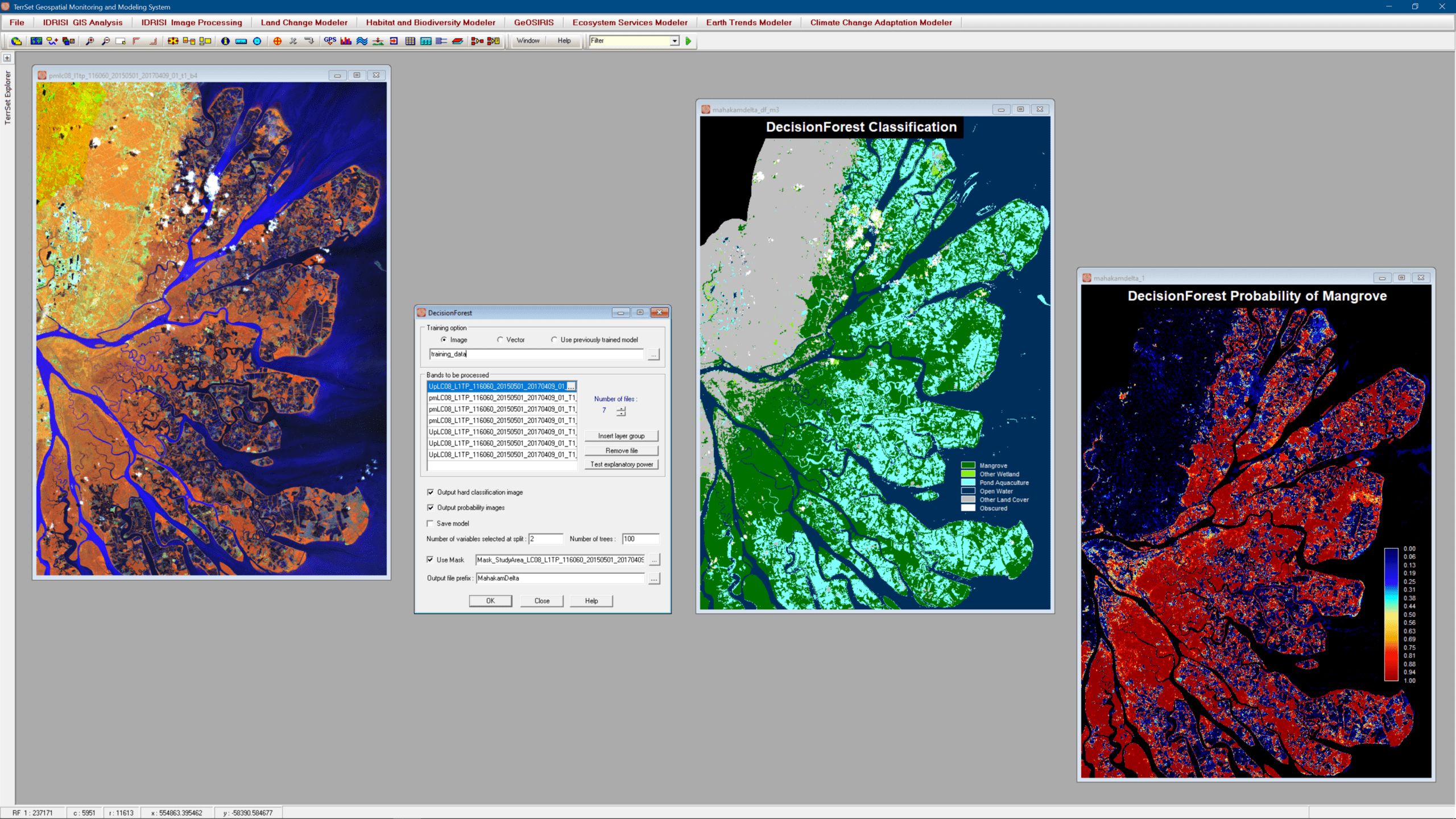
The IDRISI Image Processing component has seen extensive changes including new machine learning classifiers (SVM and DecisionForest), extensive on-screen digitizing tools, and specialized software for the ingest and radiometric correction of major provider imagery, such as Landsat, Sentinel, and DigitalGlobe (WorldView, QuickBird and GeoEye).
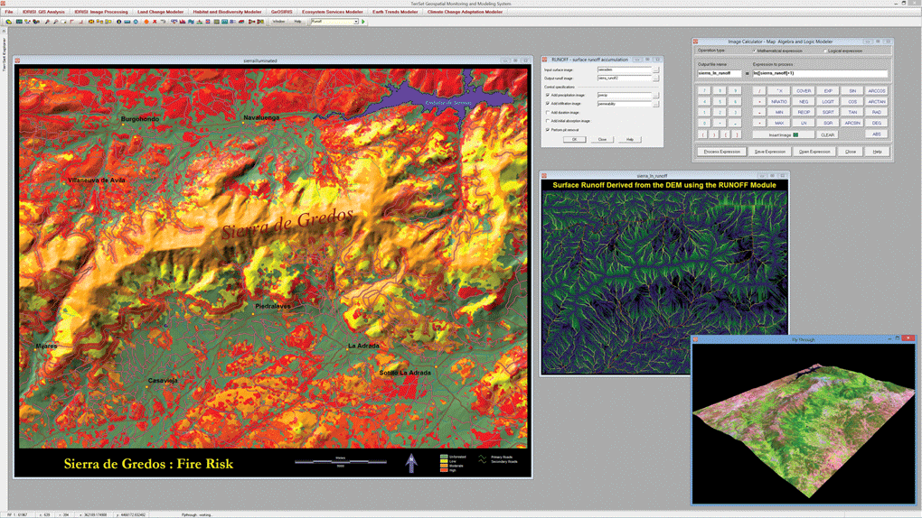
The foundation for TerrSet is the IDRISI GIS suite of analytical tools. This figure illustrates some of the many GIS analysis tools provided. These include a risk mapping based on a multi-criteria evaluation, a modeling of surface runoff incorporating information on precipitation and soil infiltration and the use of the the Image Calculator for basic map algebra tasks. The bottom right shows a view of the FlyThrough interactive 3-D flight viewer.
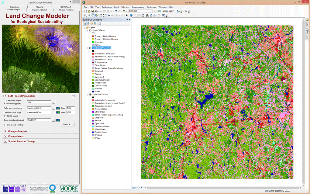
The Land Change Modeler for ArcGIS Extension is an innovative land planning and decision support software tool that is critical for smart development, biodiversity conservation and the management of climate mitigation strategies such as REDD (Reducing Emissions from Deforestation and forest Degradation). The Land Change Modeler for ArcGIS extension analyzes historical land cover data to assess, model and predict land cover change using powerful machine learning procedures.