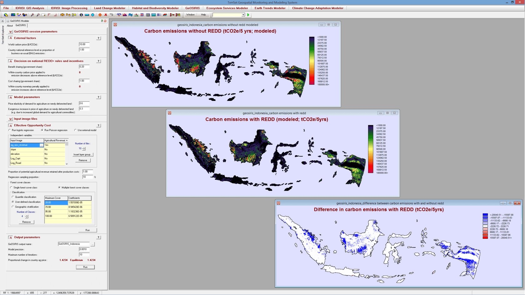
GeOSIRIS is a fully integrated decision support system within the TerrSet software for planning national-level REDD (Reducing Emissions from Deforestation and forest Degradation) activities. There are tools for quantifying and mapping the impacts of REDD projects on deforestation, carbon emissions, agricultural revenue, and carbon payments. As a spatial decision support system, GeOSIRIS can assist in the evaluation of alternative economic policy decisions for reducing greenhouse gas emissions while redistributing REDD revenues equitably. GeOSIRIS is a spatial implementation of the OSIRIS model created by Conservation International, with the added benefit of allowing users to model deforestation and carbon emissions spatially.
Key Features of GeOSIRIS REDD
- Model the impact of various economic strategies for carbon emissions reduction.
- Include key external model parameters such as global carbon pricing.
- Model how carbon revenues and penalties are shared across administrative levels.
- Model individual carbon pool emissions.
- Calculate the Effective Opportunity Cost relating to deforestation and potential agricultural revenue.
- Calculate the effect of a REDD project on a nation’s agricultural pricing strategy.